
Thanks to Our
Sustaining Members
(Click logos for more information)
and

Restaurant of Perth
and

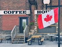
Hourglass Cafe
and

Foodsmiths
and

Rideau Valley Conservation Authority
and

Prodecal
and

(Click logos for more information)
|
Tay Watershed Information
Ken Watson's Photo Story
of the Tay Canal
Click arrow for video
and click on 360p or 480p icon and increase to 720p for HD, then click on full screen icon and sit back and enjoy.
|
Tay Watershed Maps
Did you know?
- The Tay River Watershed is approximately 850 square kilometres in size.
- The Tay River is approximately 95 km long.
- The Tay River drops an average of 1.2 metres per kilometre (6.4 feet per mile).
- There are 46 lakes in the Tay River Watershed.
- Christie Lake is 1626 acres in size.
- Otty Lake is 1664 acres in size.
- Bobs Lake is 7962 acres in size.
- There are 6 municipalities within the Tay River Watershed.
- There are 4 dams and 1 set of locks on the Tay River.
- The headwaters of the Tay River are used as a reservoir for the Rideau Canal.
- The Tay River was originally called Pike Creek.
Bodies of Water in the Tay Watershed
(For pictures of selected sites, go to the Image Gallery)
Lakes, Bays and Ponds
Top of Watershed (above north-south railroad line from Oconto to Tichborne)
| Abbott |
Danby |
*Leggat |
Miller |
| Barton |
Duncan |
Little Beaver |
Oconto |
| Carnahan |
*Eagle |
Little Mud |
Scanlin |
| Clow |
*Elbow |
Long |
Spruce |
| Watson |
|
|
|
Middle Watershed (between Oconto/Tichborne Line and Christie Lake)
| Atwood |
*Davern |
Little Rock |
*Rainbow |
| Beaver |
Deer |
*Little Silver |
Rock (north) |
| *Bobs & Crow |
Doran |
Little Twins |
Sucker |
| Buck Bay |
Farrell |
Lynn |
Thompson Pond |
| Burns Pond |
Green Bay |
Mud Bay |
Victoria |
| *Christie |
Lake of the Hills |
O'Brien |
Weatherhead |
| *Crosby |
Little Crosby |
*Pike |
|
Below Christie Lake
| Andrew |
Mclaren |
Mud Lke |
Rock (south) |
| Doctor |
Mills |
*Otty |
Thoms Mud |
* lakes that are known to have an association now or recent
Creeks in the Watershed
Above Oconto/Tichborne Line
Between the Line and Christie Lake
Below Christie Lake
| Grants |
Blueberry |
Jebbs |
Rudsdale |
| Scotts (Snye) |
|
|
|

|
|


 This work is licensed under